Where in Nigeria Can You Find Pingell Granite Placer Type Tantalum and Niobium, Tin Ore Deposits?
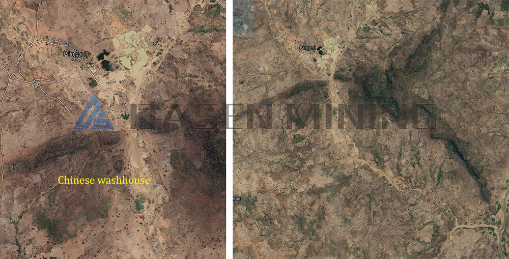
In the heart of Nigeria, a new frontier for tantalum, niobium, and tin mining is emerging, specifically in the Pingell region. This area is characterized by its unique granite placer type deposits, which are primarily alluvial, with landforms dominated by floodplains and newly formed riverbeds. These riverbeds consist of modern river channels, heart beaches, side beaches, and other micro-geomorphic features, making it a promising location for mineral extraction.
Understanding the Geology
The lithology of the area is mainly composed of sand layers and sand gravel layers, with a clay content of approximately 10%. The thickness of these layers is relatively small, typically between 0.5 to 1.0 meters. Due to the constant meandering of the river’s mainstream line caused by accumulation, which overlaps with the total forward movement and transverse circulation of the water flow, the modern riverbed continuously cuts into the floodplain and overlaps it in the form of internal superposition. Interestingly, in some river sections, the content of niobium iron minerals is still higher than the boundary grade, making it one of the main metallogenic units in the area.

tin ore is found in which state in Nigeria
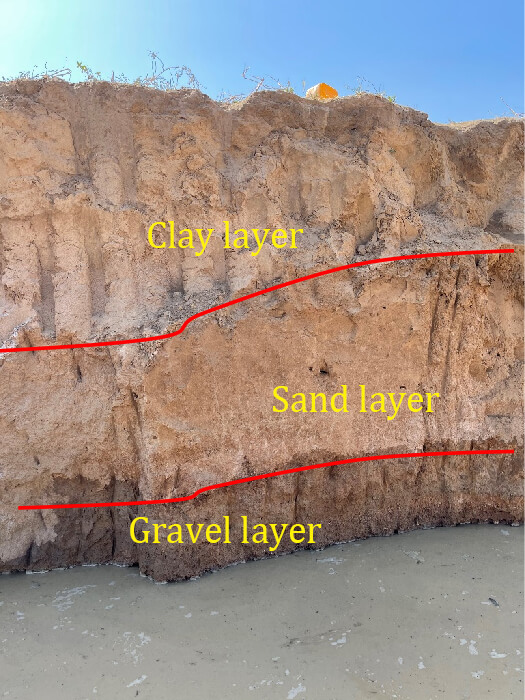
1. Clay Layer: The upper near-surface clay layer is mainly grayish brown and grayish yellow, composed of kaolinite with silty fine sand, and has a thickness of more than 0.5 meters. The clay layer in the middle and lower parts shows obvious regional zoning characteristics, being mainly cyan-gray and composed of kaolinite with a dense lithology and good water resistance.
2. Sand Layer: This is an important ore-bearing horizon in the area. The particle size distribution from top to bottom is very obvious, mostly consisting of silty sand, silty fine sand, medium coarse sand, and containing some quartz fine gravel. The sand is mainly composed of quartz, with a content of more than 65%, in addition to weathered feldspar debris and clay minerals.
3. Gravel Layer: Located at the bottom of the same sedimentary period, this layer is one of the main ore-bearing horizons, with a thickness usually between 0.5 to 3-2.4 meters. The gravel layer consists of clay minerals (15%-25%), sand (25%-45%), and gravel (30%-50%).

minerals found in Nigeria
Exploration and Development
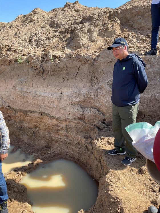
A field investigation revealed that the exposed length of the surface ore body is about 5000 meters, with a width ranging from 50 to 500 meters and an average width of about 200 meters. The thickness of the ore body is approximately 1 meter, but the grade of the ore body is currently unknown and requires further shallow well exploration and verification. Past tests have indicated a cassiterite grade of about 0.4 kg/m³, with a high grade of associated niobium, though specific details remain unclear.

minerals in Nigeria
Work Suggestion
To establish the gradation of the ore body scale and grade, it is recommended to use deep-well engineering with a project spacing of 100 * 100 meters. This will help identify the available reserves and ensure reliable resources for future development.
Whatsapp:+86 133 1927 7356
Email:[email protected]
